 Life's A Journey, Go Travel It
-
Day 29 – Life IS A Journey… Go Travel It!
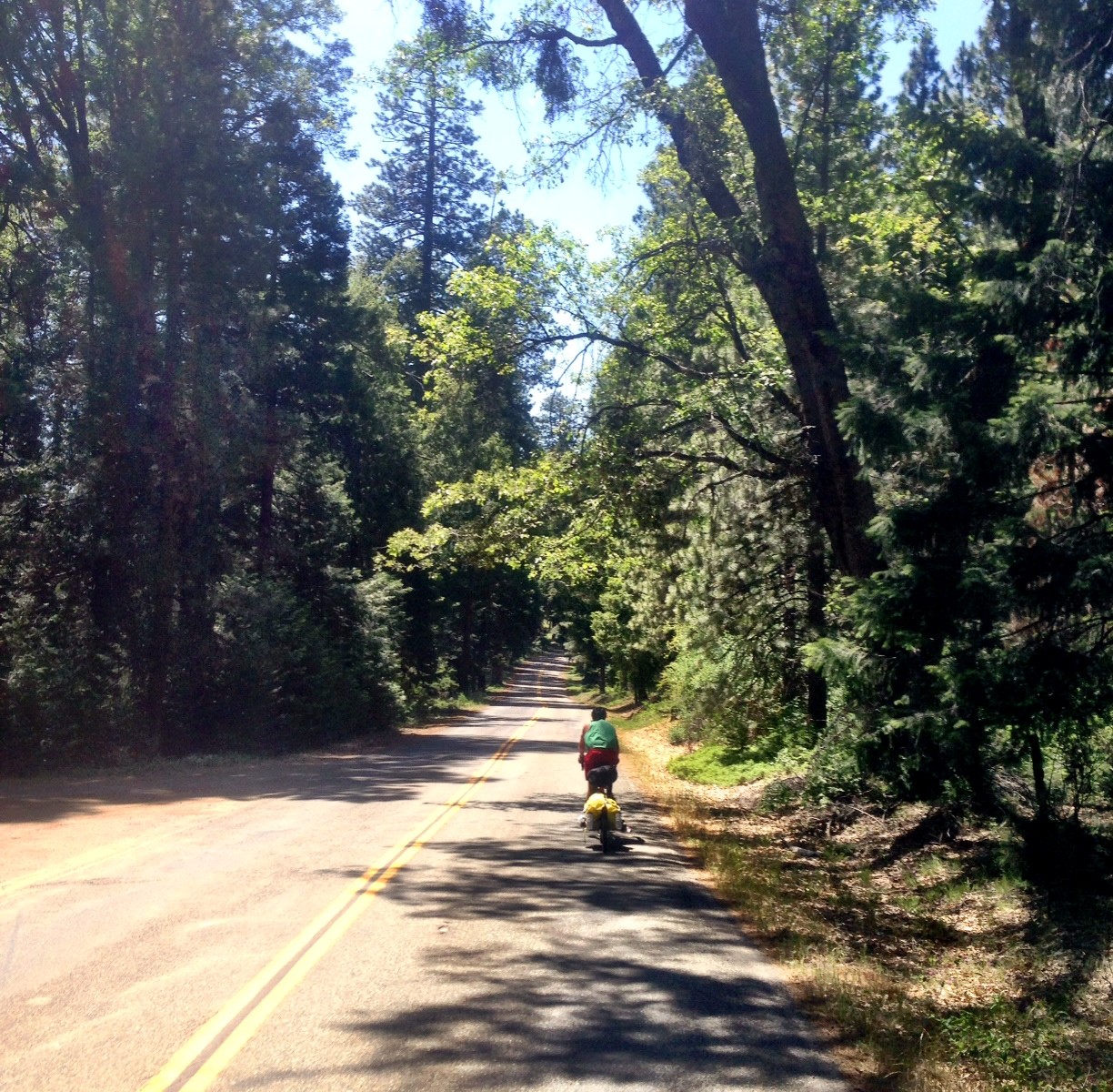
Today was it… 40 miles to the ferry at Vallejo. I was surprised by all the country roads we were traveling on when we were so close...
-
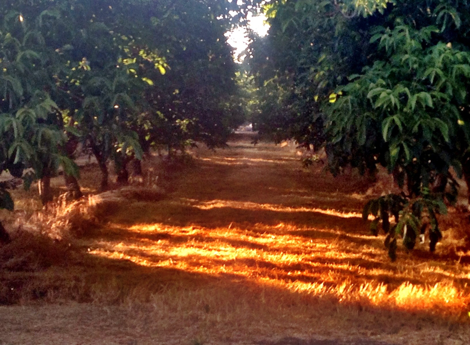
Day 28 – Californian Orchards
We got to sleep in today because the bike shop didn’t open until 9:30am. I headed out to Taco Bell breakfast around 8am and looked over our...
-
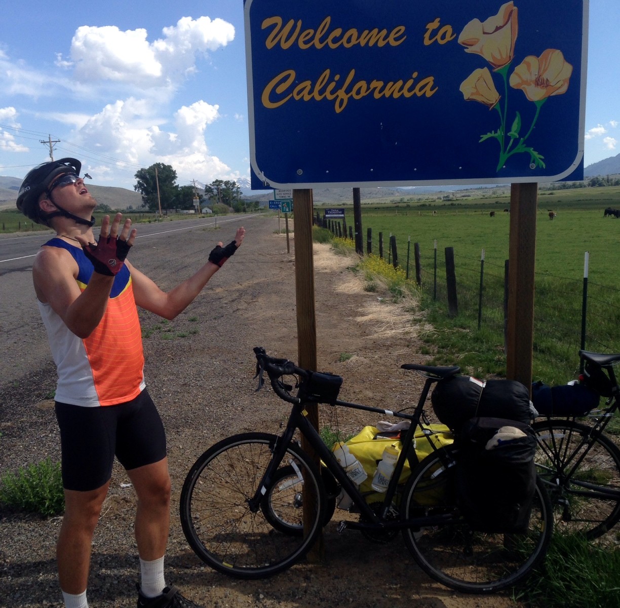
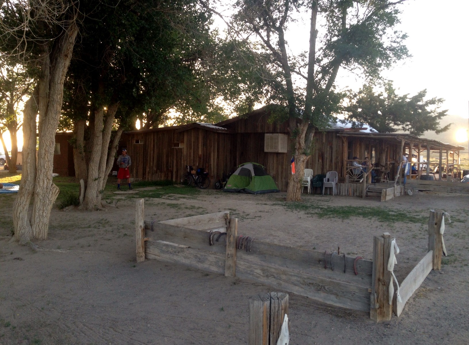
Day 27 – All Downhill From Here
This morning was a slow start after fighting the urge to stay in our warm sleeping bags, and finding out Seth had a flat tire. By the...
-
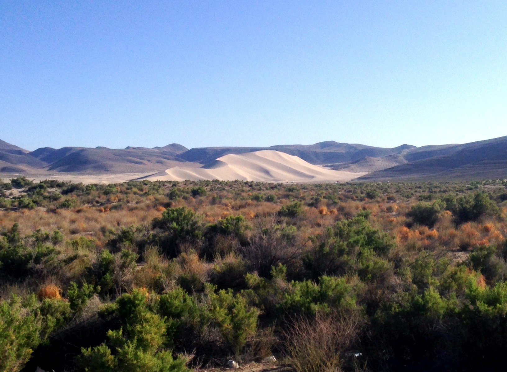
Day 26 – Century Club
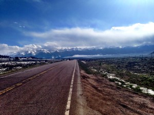
100 miles ago we were in Fallon, NV… now we’re sitting on top of Carson Pass, California which happens to be our very last mountain to get...
-
Day 25 – One Last Day Of Rest
Being bummed out from not getting the hotel room last night, today we planned on just riding 47 miles to Fallon, NV and calling it a day to...
-
Day 24 – Crushed Hope
Today we started with a climb over two mountain peaks at 6am before coasting down into Austin. It took about 3 hours to do the two peaks...
-
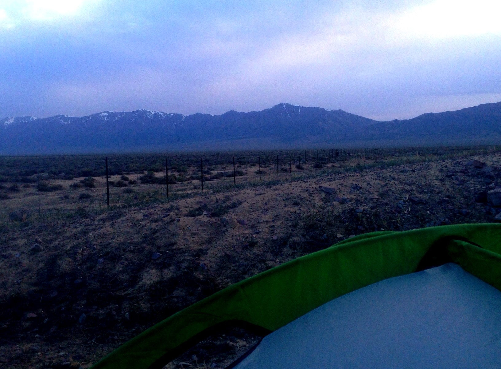
Day 23 – Lucky Number 13
*Delayed post 1 day due to no service* Yet another day on the Loneliest Road In America. The one exciting part about this day was the fact...
About
My name is Neil Emeigh. I absolutely love going on adventures and pushing myself to the limits. All the beauty on this planet wasn’t put there to not explore it and witness it, and my goal is to experience as much of it as I can in my lifetime. People call me crazy, nuts, ‘somethin else’, but a lot of those same people wish they had the spontaneity to go on the same adventures that I go on. And maybe I am crazy… who decides to ride a…
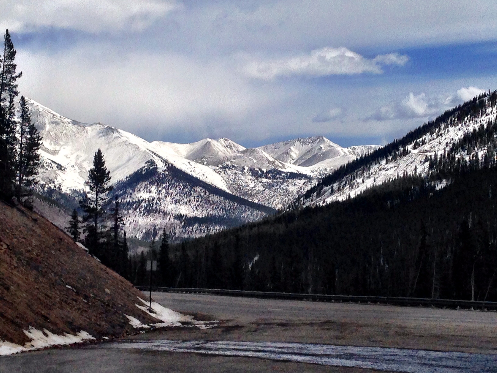
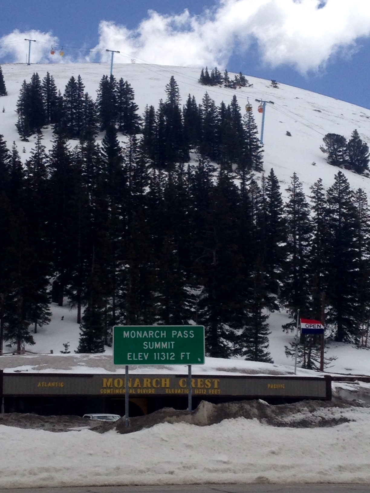
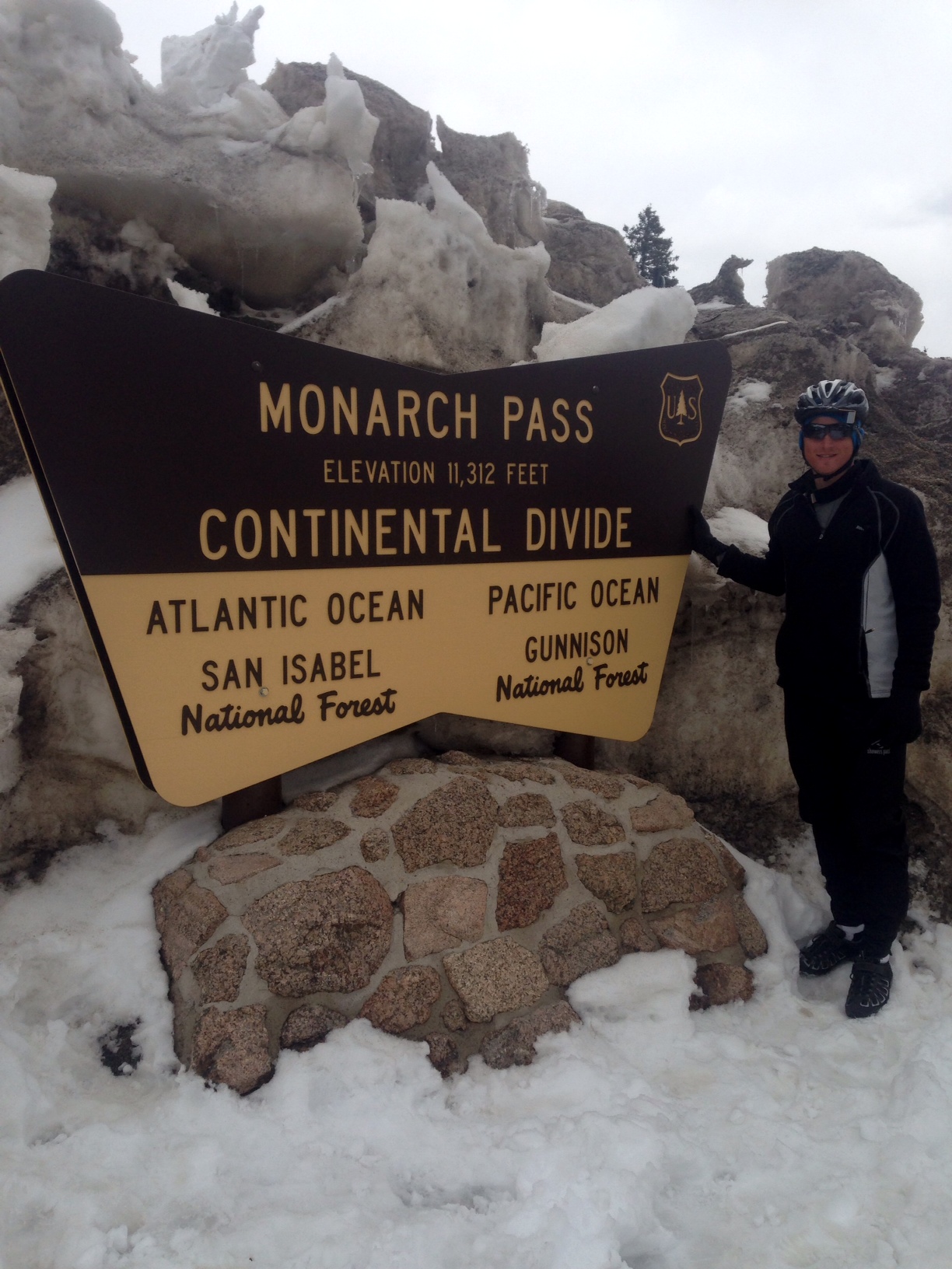
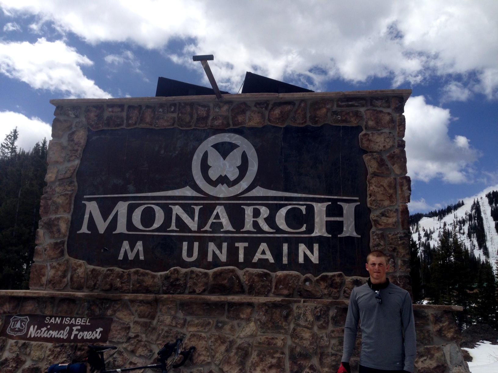
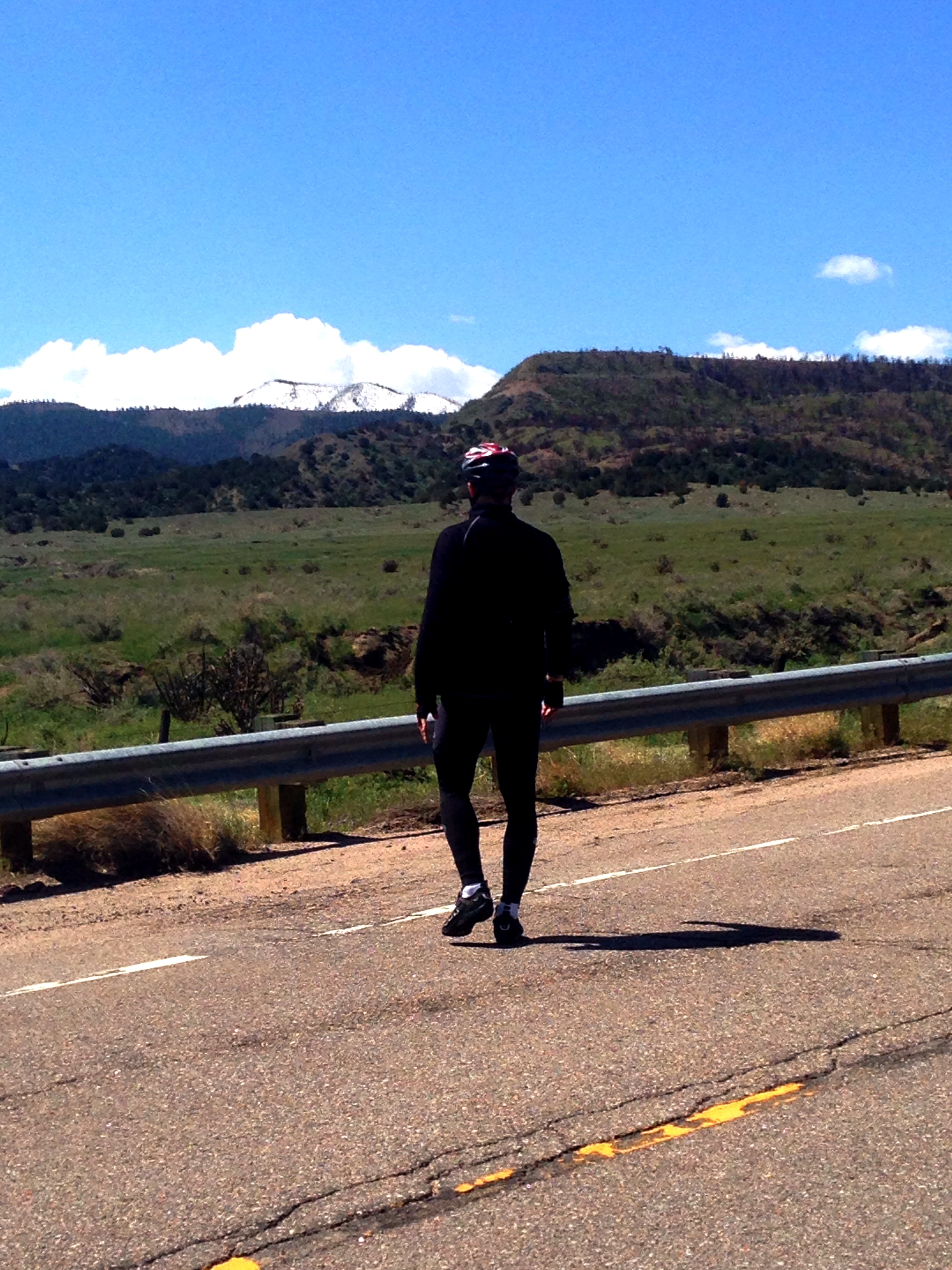
We did it. The highest peak of our journey is behind us now. Monarch’s Pass was a staggering 11300 feet in elevation, resting on the continental divide. Fortunately we had great weather all the way up, but I’ll be the first to admit that we walked 95% of it. Once we reached the top, there was a shop up there that we stopped at to get some homemade fudge, ice cream, and coffee (I never drank coffee before this trip, by the way). If you’re wondering, yes, I peed on the continental divide.
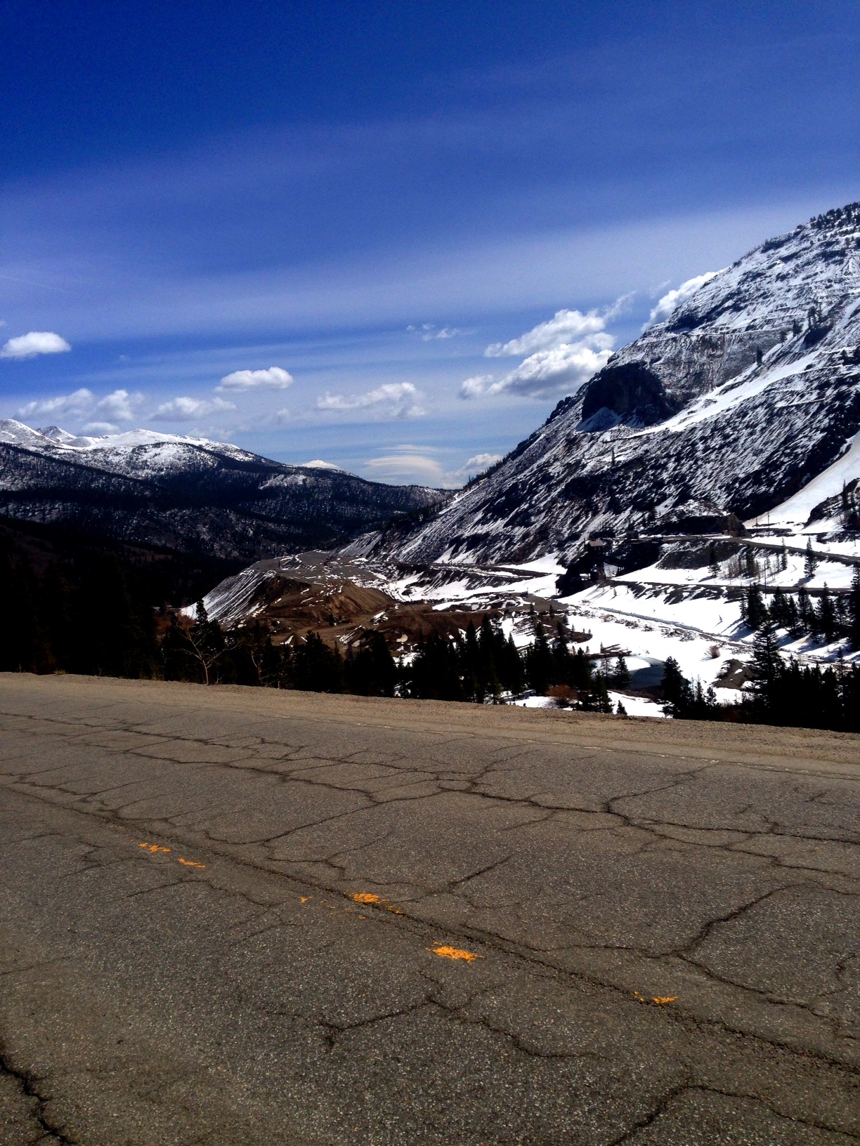
After getting rested up, we headed down the mountain at around noon. The ride down was even more of a thriller than yesterday’s descent. The speed, turns, and constant decline gave us quite the adrenaline rush. Seth will admit that he didn’t enjoy the descent all that much because it was extremely fast and one mishap on the bike, or a bump in the road, could lead to an extreme injury and the end of the trip. Luckily for him, and not so much for me, we got stuck behind a semi going down the mountain that had to go slow so it didn’t “runaway”.
At the bottom of the true descent we pulled over to take some of our gear off. Riding down the mountain is extremely chilling because you don’t use any muscles to keep your body warm. As we were about to take off, a man in an old Cadillac pulled over to ‘admire’ our bike trailer. Little did we know, he began to tell us his life story, and how he’s just driving across the United States now, and how we have a place to stay if we ever go to central Arkansas (which probably won’t happen…). Finally he got the hint we needed to get going, so he hopped in his car and drove off.
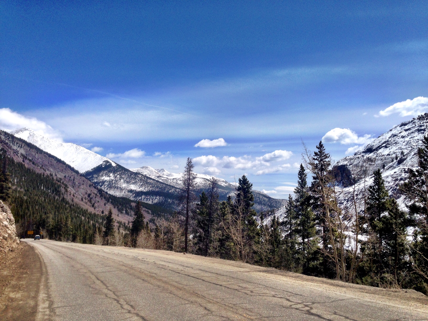
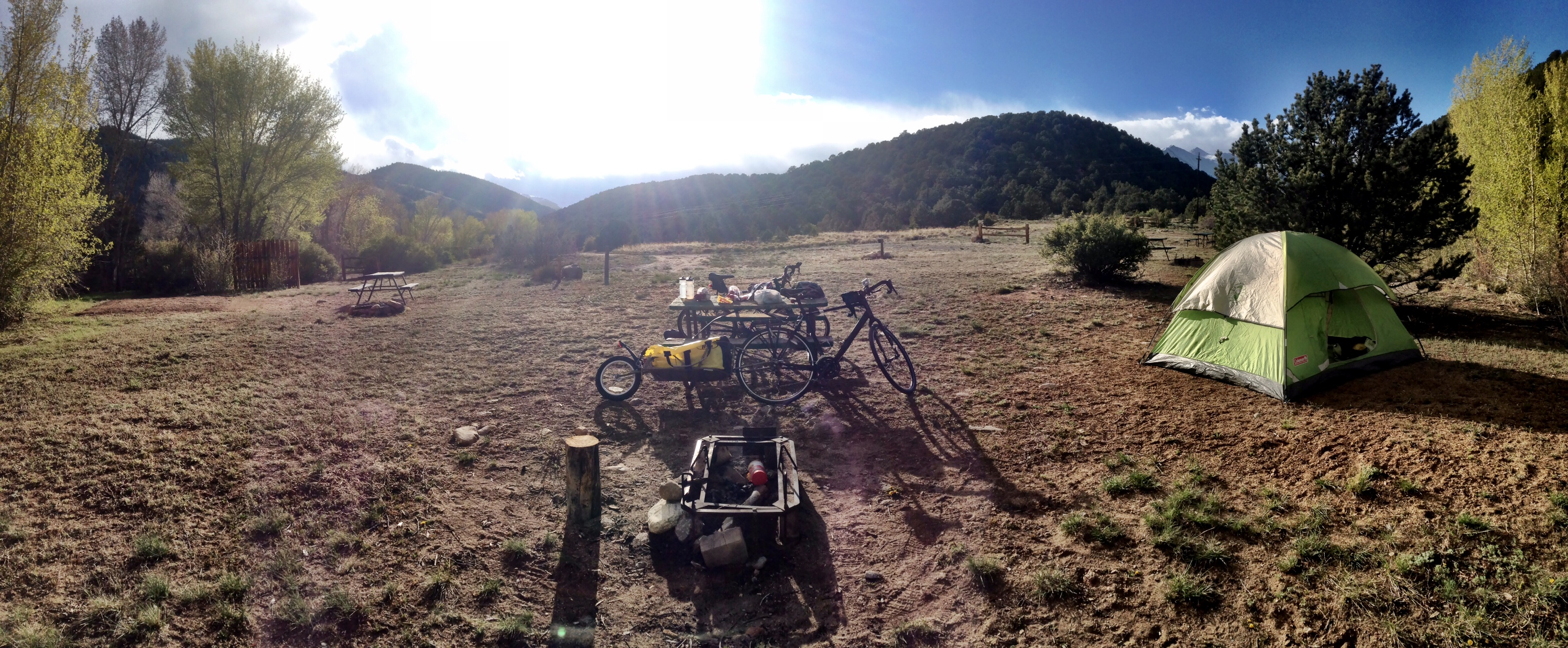
Going around the next bend in the road greeted us with a nasty 20mph+ wind right in our face. Mile after mile it kept blowing at us, and looking ahead it was apparent there were some storm clouds. Luckily it only sprinkled for a minute, but the wind persisted for many miles which unfortunately put us behind our goal for the day. We had to settle in the town of Gunnison, CO because of our slow pace to get that far.
Tonight we are tenting in a nice KOA campground. We’re striving to get to Montrose tomorrow, which is only 64.6 miles, however there are some steep mountains along the way. If the weather is right, it should be doable!
Total miles biked: 53.4 miles from Maysville, CO to Gunnison, CO
“The biggest adventure you can ever take is to live the life of your dreams.” ― Oprah Winfrey


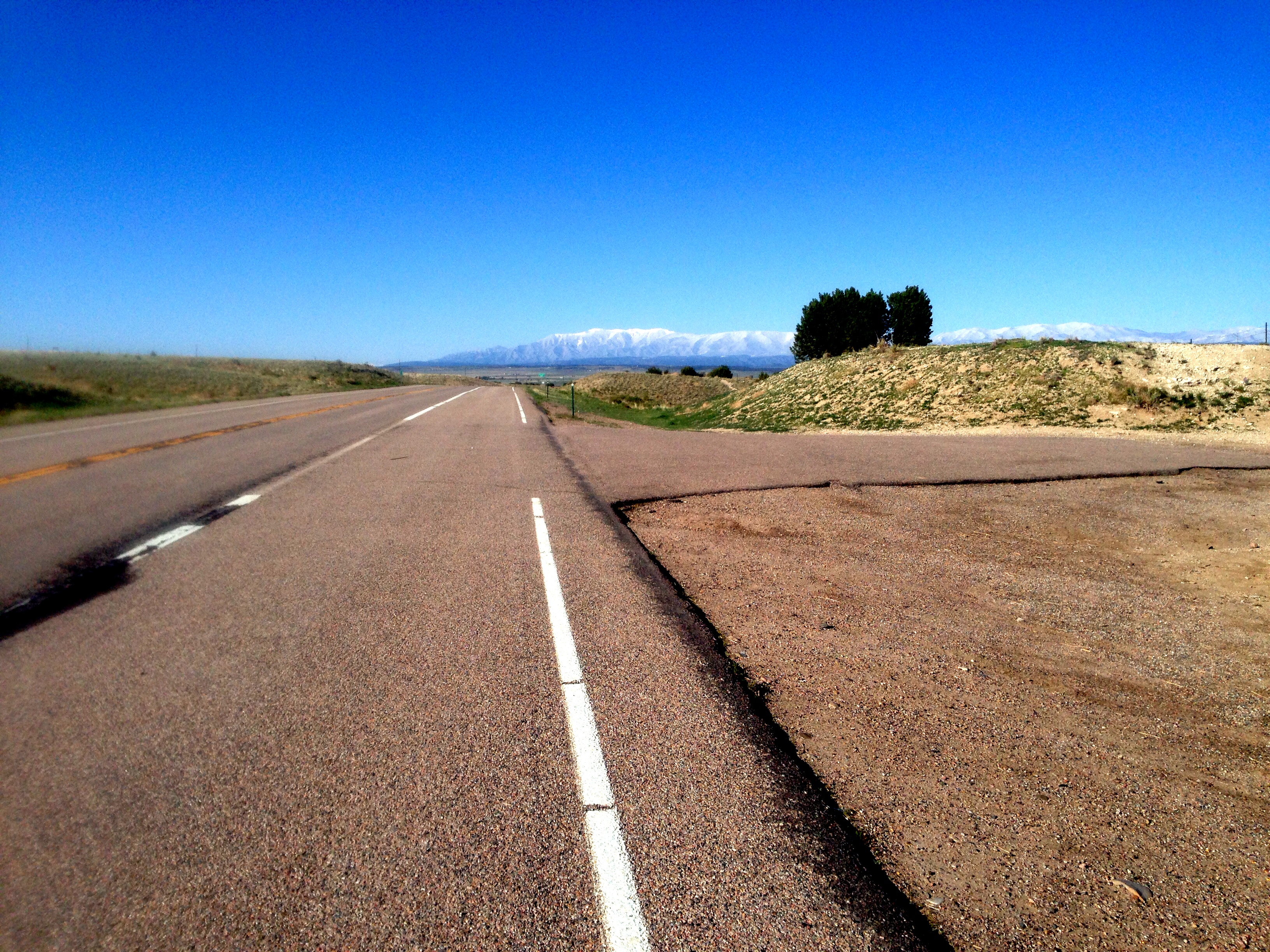
The morning started off with another flat right as we were leaving the hotel room. Luckily I noticed it on my tire before we checked out, so we were able to change it in the warm room. After that, the first half of today was all downhill, as we stayed pretty high up last night after getting over that mountain. It was great to be able to coast for miles, but we knew the other half of the day was right back uphill. The final stretch of going downhill landed us in Cotapaxi, CO. The road going down was at a consistent 4%+ grade for about 4 miles – it was like a scary rollercoaster! My hands were constantly pulling the brakes, and I knew that any fault in my bike or any large bump in the road would lead to severe injury (we were going THAT fast). Seth was unable to check his watch to clock our speed, but I venture to say we got above 40mph+ on most of it.
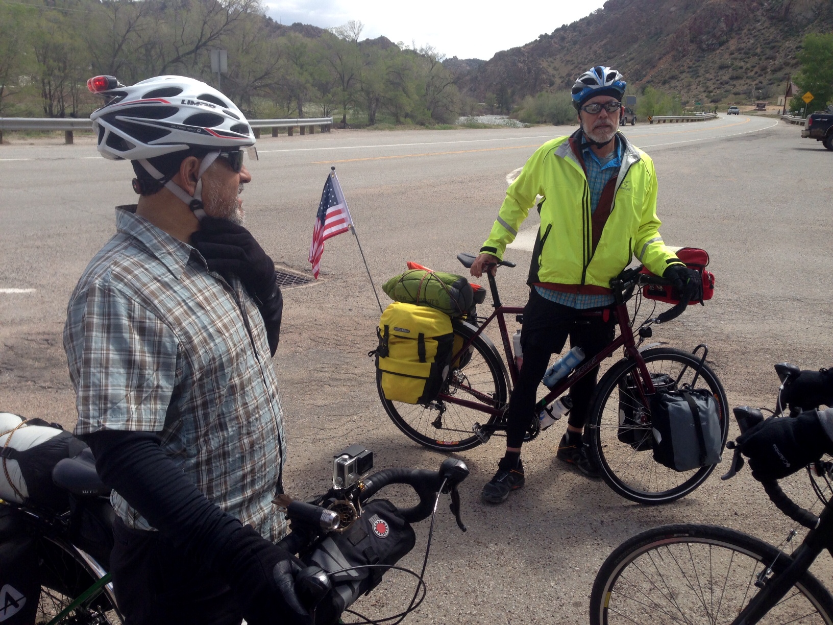
Upon reaching Cotapaxi, we were just about to cross the highway that we needed to get along when, finally, two other cyclists came cruising right to us! It was such a relief to talk to some people who had crossed the mountains we were soon to go over. The four of us talked strategy, mapping, and anything else that relates to biking for a good 15 minutes. Victor and Tor (awesome name, right?) said they were from San Diego and were heading all the way to Virginia! Victor told us that Tor was turning 60 years old on this trip, which only reminded Seth and I that we have absolutely nothing to complain about. We all wished each other luck and headed down our paths.
We stopped in Salida, CO to eat a late lunch at Subway. By 2:50pm we were heading out to our last 10 miles to the town of Maysville, which we knew had a campground. It took longer than expected because the climb to the top of Monarch’s Pass started now. Tomorrow we will go over Monarch’s Pass – our tallest peak on the entire journey! We pushed really hard to get to Maysville tonight because it is only 12-13 miles to the peak, so hopefully we can reach the peak before 1pm. Conquering that Pass tomorrow will mean we have finally crossed the continental divide!
Total miles biked: 57.8 miles from Westcliffe, CO to Maysville, CO
“The purpose of life is to live it, to taste experience to the utmost, to reach out eagerly and without fear for newer and richer experience.” ― Eleanor Roosevelt
Seth and I thought we knew hills and climbing… before today.
This marks the completion of day 7 of our journey thus far, and today definitely tested us. After staying the night in Pueblo last night, we started heading out of town at around 7:30. There was an extremely steep grade (5%+) for a good half mile right at the beginning of our route, but we disregarded it as a one-time mishap… boy were we wrong.
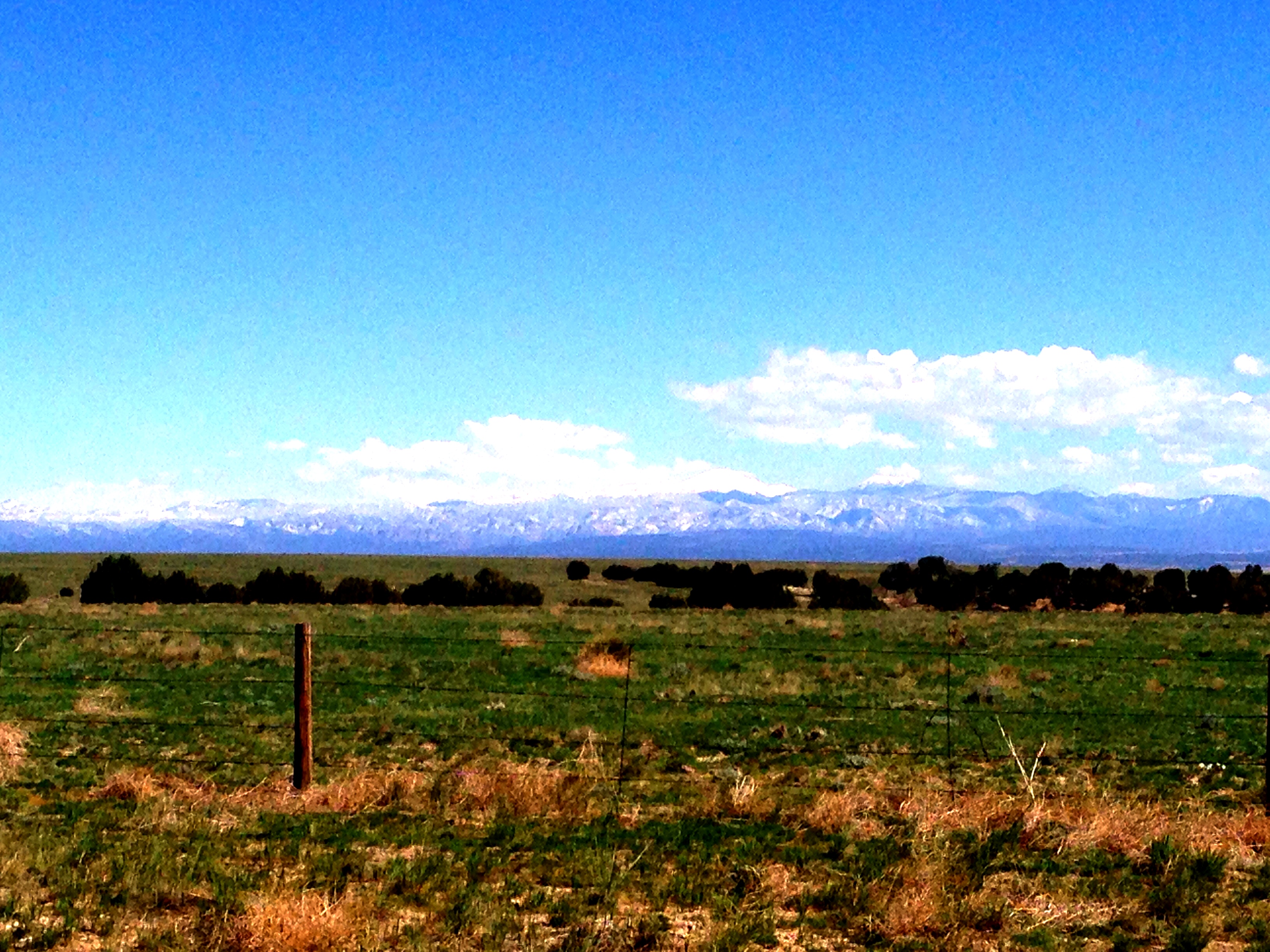
Upon reaching the top of this incredible climb, our first look of the mountains finally came! Such an amazing view and a breathtaking experience. Little did we know that this was only the beginning of the amazement we were in store for.
The day went on, very slowly, and both our spirits were low. Hill after hill we kept pedaling over, as well as the wind blowing directly into our face. Admittedly we walked A LOT of miles today – it was simply impossible with the load we have to be able to bike up these steep grades.
Anyways, we marched on until our path crossed Wetmore, CO. An old man was outside cleaning some branches outside of the town’s public library (that’s all they had that was public), so we asked him where we could find some water. He gladly opened up the library for us and let us inside to fill our bottles up.
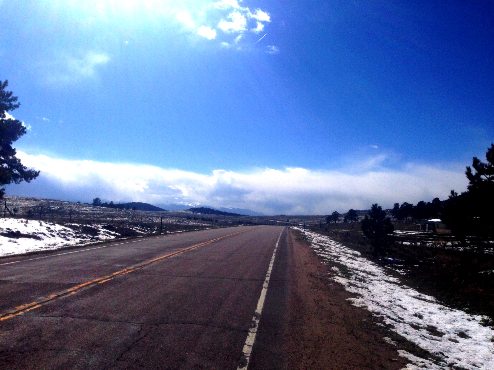
Soon after chatting with him for a while and eating lunch, we took off up the dreaded mountain. The next 12 miles would move us from 6000 ft elevation to 9000 ft elevation – you can about imagine the steepness of what was about to come. Originally, Seth and I planned to camp alongside the mountain overnight and just get as far as we could. At one point, 7 miles up (unknowingly at the time), snow started coming down pretty fiercely. Being from Nebraska, you don’t expect a ‘snow shower’ to last a couple minutes, but we panicked expecting a Nebraska blizzard and coincendentally were right by a small off-road campground. We quickly set up camp as the snow kept coming down, and within 15 minutes we were ready for the night… except it was only 2pm, AND the snow already ceased. The decision now was to pack everything back up and keep walking up the mountain for a few more hours, or just sit out the rest of the sunny day.
… we kept on. Keep in mind, we’re pulling 40ish pounds of gear with us, and walking up a 5-8% grade mountain for another 6 miles. It definitely took its toll on us. There were no parts along this walk that we could even hop on our bike to ride a little, it just wasn’t possible to pedal anywhere… so we kept walking. At this point, both Seth and I would chime in at different times and tell one another “Hey, this part is going down hill, let’s coast it out” (this happened MANY times), but to our disappointment it was all an illusion with how the mountains slanted and the hills were actually still going up more. This happened way too many times!
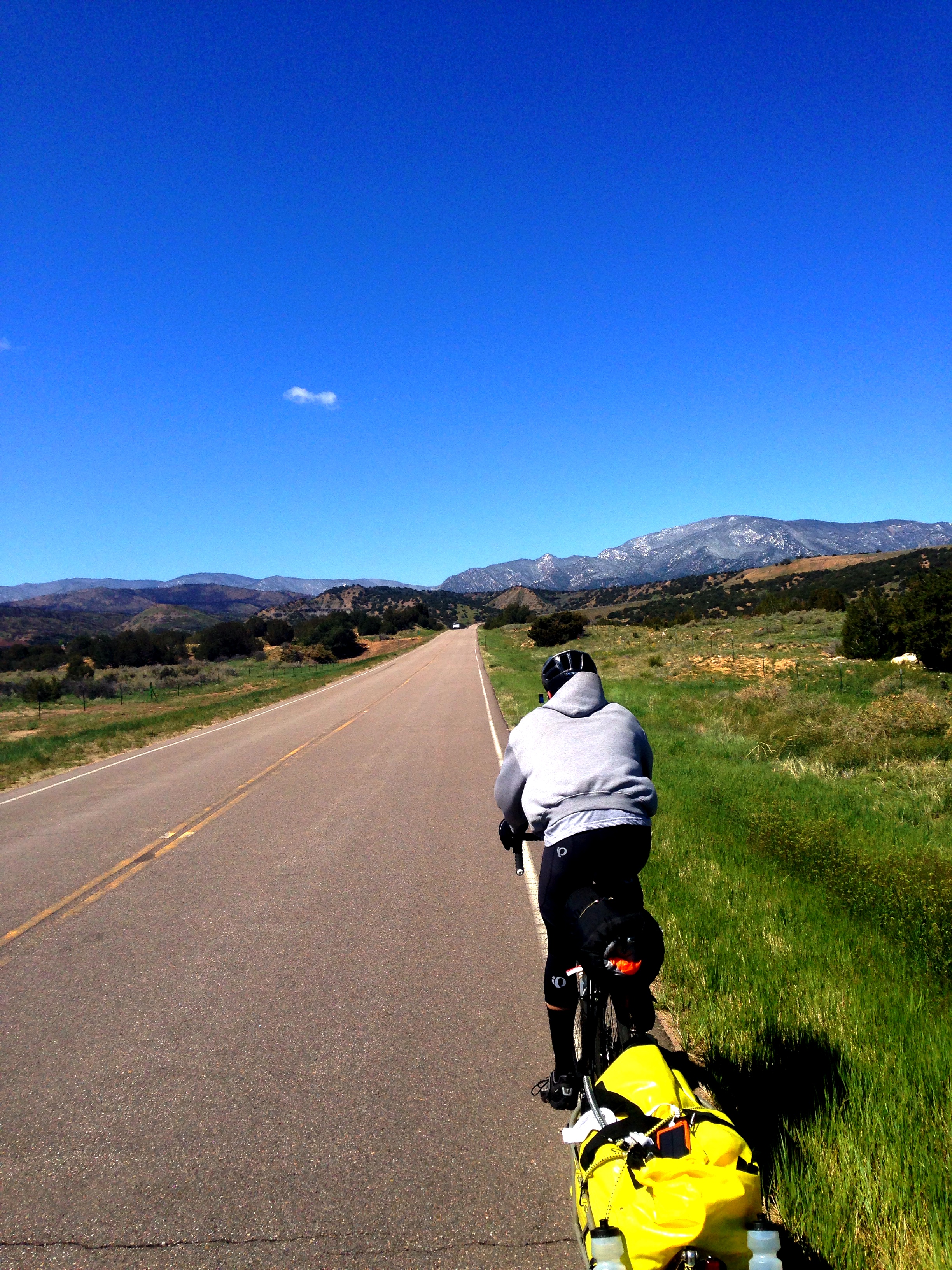
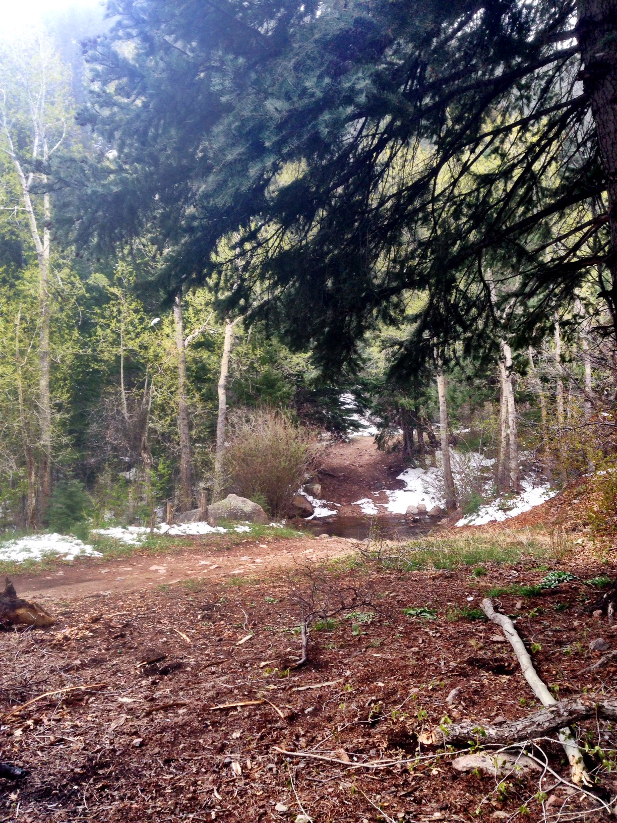
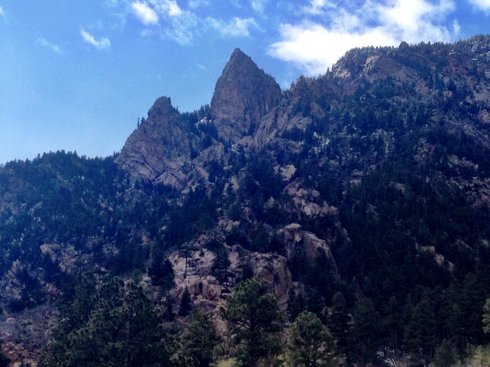
The mile markers kept getting lower though, and we pressed on with the sun high above our heads. I could tell you about all the hardships this caused us physically and mentally, but you get the point by now. Right before making it to the top of the mountain, we were lucky enough to see some wild goats, that was a cool pick-me-up. Eventually we made it and began our descent. During this descent some of the most INCREDIBLE scenery I have ever seen in real life, and photographs, came into view (see pictures below). This was enough for us to ride down the mountain (going 40mph+ on many parts) and reach our destination for today – Westcliffe, CO.
Although today was a huge hit to us physically and mentally, the sights we were able to see and soak in being on a bike are unforgettable. Now that I’ve went through it, these are things I will have with me the rest of my life – and I’m glad (as I sit in our hotel room, and not walking up the mountain!) that I did it.
Total miles biked: 57 miles
“Never stop just because you feel defeated. The journey to the other side is attainable only after great suffering.” ― Santosh Kalwar

Finally made it to Pueblo, CO! Being rested from the hotel two nights ago, and sitting in our tent all day yesterday, we both agreed that we could do the 90 mile jaunt to Pueblo, CO today – which we did. The terrain is starting to become more hilly and mountainous the further we go on, so that made things a little though today, but luckily we were spared by the wind.
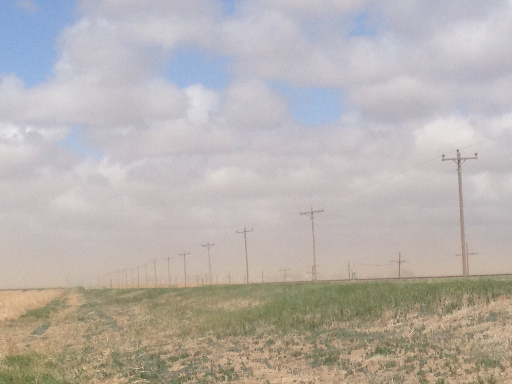
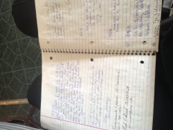
Our first stop today was 30 miles down the road in Sugar City, CO where I needed to sit in a cafe to defrost my feet. My toes had been numb all morning, which is a typical morning usually, but today I felt the numbness crawling up to the arch of my foot – I needed to warm up right away! We went into a very dated cafe in this small town and were quickly surprised by the lady working there with a notebook put in front of us. She said that all the cyclists from 2008 have been writing in this notebook as they pass through, and just like all the others, Seth and I wrote a little excerpt as well. It was very cool reading all the other stories and journeys that other people had been through, and extremely motivating to us as well.
From Sugar City, our next stop was a long ways up the road at Boone, CO, which was 23 miles from Pueblo. Before reaching Boone, we rode past two penitentiaries, and saw our first glimpse of some wildlife! Seth pointed out a deer running alongside us, and sure enough he jumped down the hill he was running on and crossed right in front of us.
Upon reaching Boone, the mountains were finally within sight! It has a bitter sweetness to it – on one hand it’s great to think of all the beautiful views we will soon be encountering, but on the other hand we will have to begin our true ascent into the skies. Tomorrow’s elevation profile is showing that we will climb 1000 feet in just 30 miles. If we are feeling good after that and decide to press on, the next 15 miles yields a 3000 feet climb. Things are about to get interesting…
Total miles biked: 89 miles from Haswell, CO to Pueblo, CO
“The beautiful journey of today can only begin when we learn to let go of yesterday.” ― Steve Maraboli
(didn’t get any real pictures today since we had to press hard to get to Pueblo. The one below is from the notebook at Sugar City.)
Day 5 started out with a nasty, chilling, wind from the North. We were well rested from the hotel though so we were anxious to get out on the road. Luckily the 25mph wind pushed us down the highway as we traveled South for 20 miles. A mere 50 minutes later we had travelled that whopping 20 miles, clocking in at over 30mph speed on some miles. Spirits were high!
And then everything took a change for the worst. That same wind kicked up to 30mph and was a crosswind as we rode West. It pushed our bikes to the center of the barren highway and our gears were as low as they could go. At one point there was some serious looking cloud-looking formations about .5 miles ahead of us, making the visibility no more than that. We began to worry that there may be a storm up ahead and decided to hide out in ditch for a little bit. With no cellphone service, a windchill below 19 degrees, and progress too slow to push on, we were in for a treat.
Then, our luck changed. A man in his diesel pickup truck pulled over by the highway that we were lying on and asked us if we needed any help. With a lot of hesitation, we decided to make today our first cheat day. I had hoped not to have to hitchhike anytime throughout the trip, because then it wouldn’t necessarily be considered “biking to California”, but our options were limited when he told us the next town was 20 miles away. We loaded up our bikes and trailer and hopped in for a ride to that town. I have regrets for doing it, but we were on a very tight schedule and can’t afford to get behind schedule so early in the trip.
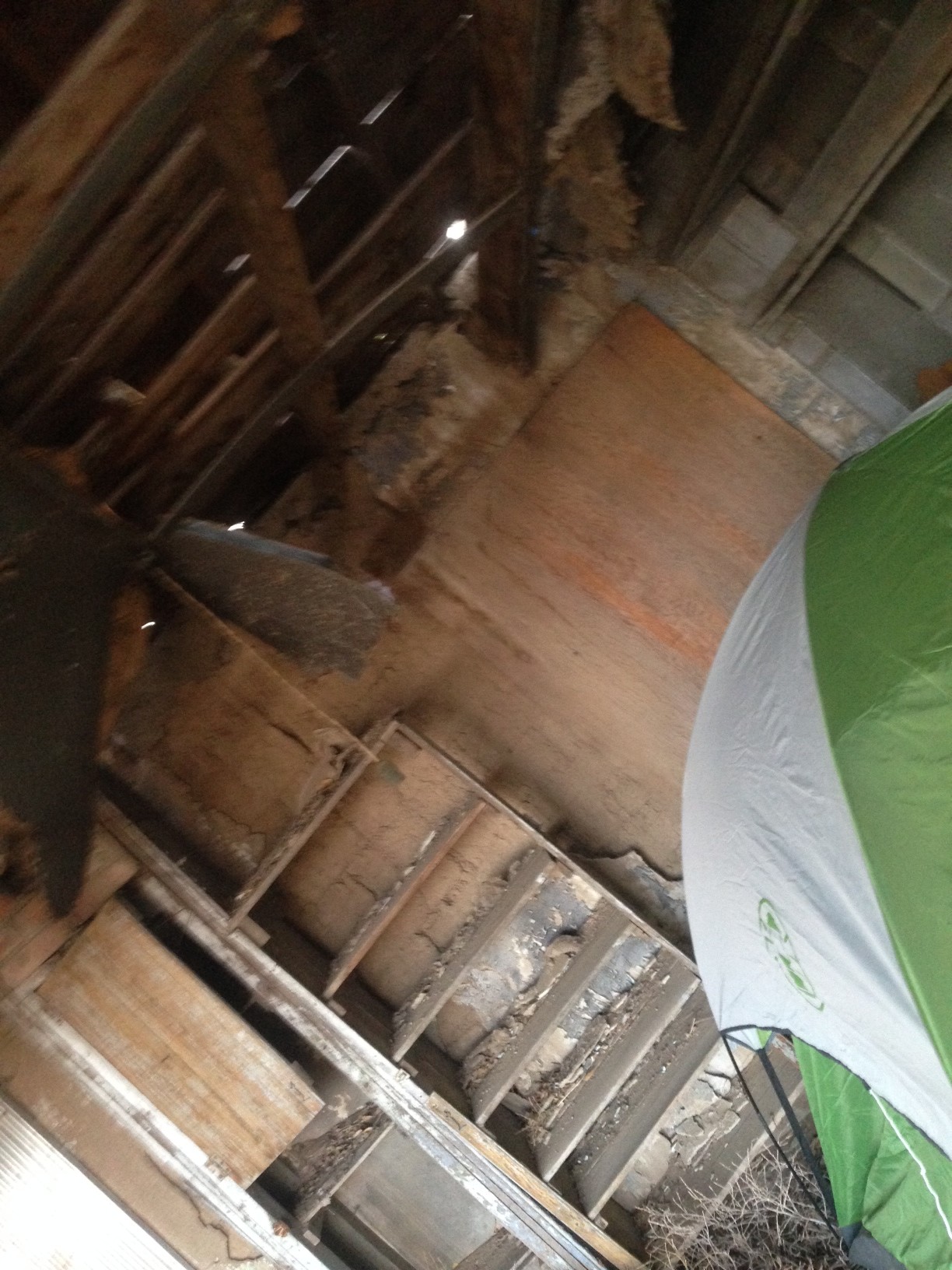
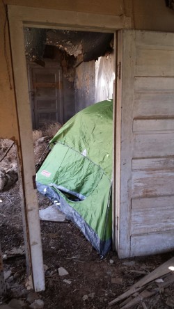
Arriving at Haswell, CO greeted us with a city park, but nothing to hide our tent behind. With winds gusting well over 30mph and the temperatures dropping lower, Seth pointed out a “nice” looking abandoned house across the road from the park. Inside it we discovered it was an old sod house, boards hanging from the ceiling, and rubble scattered across the floor. We decided it was worth the risk staying in this building and keeping warm, rather than our tent blowing away and being cold tonight when the temperature drops below freezing. [We find out the next day in Sugar City that the place was called “Prairie Dog Café”]
Here ends the day… total miles biked: 23ish, and a 17 mile ride to the nearest town.
Let’s hope tomorrow is better…
“…there ain’t no journey what don’t change you some.” ― David Mitchell, Cloud Atlas